Cartography
-
![Navionics Navionics+ NAUS008R U.S. West [010-C1371-30] MyGreenOutdoors Navionics Navionics+ NAUS008R U.S. West [010-C1371-30] MyGreenOutdoors](https://cdn11.bigcommerce.com/s-ktouu2lc/images/stencil/590x590/products/62023/125274/Navionics-NAUS008R-US-West-010-C1371-30_80164__54630.1716031388.jpg?c=2)
Navionics
Navionics+ NAUS008R U.S. West [010-C1371-30]
$149.99NAUS008R - U.S. West - Navionics+Get the world’s No. 1 choice in marine mapping - with the best, most up-to-date Navionics+ cartography on your compatible chartplotter. For offshore or inland waters, this all-in-one solution offers...$149.99 -
Out of Stock
![C-MAP C-MAP 4D Lakes NA-D073 North East [NA-D073] MyGreenOutdoors C-MAP C-MAP 4D Lakes NA-D073 North East [NA-D073] MyGreenOutdoors](https://cdn11.bigcommerce.com/s-ktouu2lc/images/stencil/590x590/products/40664/111009/C-MAP-4D-Lakes-NA-D073-North-East-NA-D073_43919__69624.1715976072.jpg?c=2)
C-MAP
C-MAP 4D Lakes NA-D073 North East [NA-D073]
$187.004D Lakes NA-D073 North EastC-MAP charts have long been held in high regard by boaters because they combine aesthetically pleasing vector electronic charts with reliable sources. With the backing of Jeppesen's parent company Boeing, a...$187.00 -
Out of Stock
![C-MAP C-MAP 4D NA-D024 - USA West Coast & Hawaii - Full Content [NA-D024-FULL] NA-D024-FULL MyGreenOutdoors C-MAP C-MAP 4D NA-D024 - USA West Coast & Hawaii - Full Content [NA-D024-FULL] NA-D024-FULL MyGreenOutdoors](https://cdn11.bigcommerce.com/s-ktouu2lc/images/stencil/590x590/products/23094/106239/C-MAP-4D-NA-D024-USA-West-Coast-Hawaii-Full-Content-NA-D024-FULL_25138__95021.1715956394.jpg?c=2)
C-MAP
C-MAP 4D NA-D024 - USA West Coast & Hawaii - Full Content [NA-D024-FULL]
$353.00NA-D024 - U.S. West Coast to Mexico and HawaiiCoverage of the Pacific Coast of the United States, including all of the coasts of California, Oregon and Washington. Coverage of Baja California and Mexico down to Puerto Vallarta. Detail of the Columbia...$353.00 -
![C-MAP C-MAP M-NA-Y213-MS US Lakes East REVEAL Inland Chart [M-NA-Y213-MS] MyGreenOutdoors C-MAP C-MAP M-NA-Y213-MS US Lakes East REVEAL Inland Chart [M-NA-Y213-MS] MyGreenOutdoors](https://cdn11.bigcommerce.com/s-ktouu2lc/images/stencil/590x590/products/59045/122255/C-MAP-M-NA-Y213-MS-US-Lakes-East-REVEAL-Inland-Chart-M-NA-Y213-MS_75527__88843.1716019985.jpg?c=2)
C-MAP
C-MAP M-NA-Y213-MS US Lakes East REVEAL Inland Chart [M-NA-Y213-MS]
$179.00M-NA-Y213-MS US Lakes East REVEAL™ Inland ChartWhether cruising or fishing or C-MAP® REVEAL™ Lakes charts offer the very best of C-MAP. With Shaded Relief, including Reveal Seafloor, Aerial Photography and Satellite Overlay presentation...$179.00 -
Out of Stock
![Garmin Garmin BlueChart g2 HD - HXEU016R - Mediterranean Southeast - microSD/SD [010-C0774-20] 010-C0774-20 MyGreenOutdoors Garmin Garmin BlueChart g2 HD - HXEU016R - Mediterranean Southeast - microSD/SD [010-C0774-20] 010-C0774-20 MyGreenOutdoors](https://cdn11.bigcommerce.com/s-ktouu2lc/images/stencil/590x590/products/24970/107027/Garmin-BlueChart-g2-HD-HXEU016R-Mediterranean-Southeast-microSDSD-010-C0774-20_27016__05621.1715959549.jpg?c=2)
Garmin
Garmin BlueChart g2 HD - HXEU016R - Mediterranean Southeast - microSD/SD [010-C0774-20]
$129.99$116.99BlueChart® g3 HD - HXEU016R - Mediterranean Southeast - microSD™/SD™Coverage:From Gulluk, Turkey east to include Cyprus, Syria, Lebanon and Israel, then west to Misratah, Libya.Unparalleled Coastal Chart CoverageProvides industry-leading...$129.99$116.99 -
Out of Stock
![Garmin Garmin BlueChart g2 HD - HXUS021R - California - Mexico - microSD/SD [010-C0722-20] 010-C0722-20 MyGreenOutdoors Garmin Garmin BlueChart g2 HD - HXUS021R - California - Mexico - microSD/SD [010-C0722-20] 010-C0722-20 MyGreenOutdoors](https://cdn11.bigcommerce.com/s-ktouu2lc/images/stencil/590x590/products/24940/107005/Garmin-BlueChart-g2-HD-HXUS021R-California-Mexico-microSDSD-010-C0722-20_26986__70346.1715959460.jpg?c=2)
Garmin
Garmin BlueChart g2 HD - HXUS021R - California - Mexico - microSD/SD [010-C0722-20]
$149.99$131.99BlueChart® g3 HD - HXUS021R - California - Mexico - microSD™/SD™Coverage:Point Arena to Puerto Vallarta, including Mendocino, San Francisco Bay, Channel Islands, San Diego, and the Baja Peninsula. General coverage for the Mexican coast,...$149.99$131.99 -
Out of Stock
![Garmin Garmin BlueChart g2 Vision HD - VCA018R - Inside - Outside Passage - microSD/SD [010-C1105-00] 010-C1105-00 MyGreenOutdoors Garmin Garmin BlueChart g2 Vision HD - VCA018R - Inside - Outside Passage - microSD/SD [010-C1105-00] 010-C1105-00 MyGreenOutdoors](https://cdn11.bigcommerce.com/s-ktouu2lc/images/stencil/590x590/products/25154/107070/Garmin-BlueChart-g2-Vision-HD-VCA018R-Inside-Outside-Passage-microSDSD-010-C1105-00_27200__91914.1715959723.gif?c=2)
Garmin
Garmin BlueChart g2 Vision HD - VCA018R - Inside - Outside Passage - microSD/SD [010-C1105-00]
$349.99$295.99BlueChart® g3 Vision® HD - VCA018R - Inside - Outside Passage - microSD™/SD™Coverage:Inside and Outside Passages around Vancouver Island, specifically: the Strait of Juan de Fuca, the Johnstone Strait, the Strait of Georgia, the...$349.99$295.99 -
![Garmin Garmin BlueChart g2 Vision HD - VUS038R - New York - Chesapeake - microSD/SD [010-C1004-00] 010-C1004-00 MyGreenOutdoors Garmin Garmin BlueChart g2 Vision HD - VUS038R - New York - Chesapeake - microSD/SD [010-C1004-00] 010-C1004-00 MyGreenOutdoors](https://cdn11.bigcommerce.com/s-ktouu2lc/images/stencil/590x590/products/25052/107056/Garmin-BlueChart-g2-Vision-HD-VUS038R-New-York-Chesapeake-microSDSD-010-C1004-00_27098__91377.1715959667.jpg?c=2)
Garmin
Garmin BlueChart g2 Vision HD - VUS038R - New York - Chesapeake - microSD/SD [010-C1004-00]
$349.99BlueChart® g3 Vision® HD - VUS038R - New York - Chesapeake - microSD™/SD™Coverage:Raritan Bay to Virginia Beach including Tarrytown, Fire Island Inlet, the entire New Jersey coastline, the C&D Canal, Delaware Bay, the Delaware...$349.99 -
Out of Stock
![Garmin Garmin BlueChart g2 Vision HD - VUS517L - Alaska South - microSD/SD [010-C0887-00] 010-C0887-00 MyGreenOutdoors Garmin Garmin BlueChart g2 Vision HD - VUS517L - Alaska South - microSD/SD [010-C0887-00] 010-C0887-00 MyGreenOutdoors](https://cdn11.bigcommerce.com/s-ktouu2lc/images/stencil/590x590/products/24924/107004/Garmin-BlueChart-g2-Vision-HD-VUS517L-Alaska-South-microSDSD-010-C0887-00_26970__33738.1715959456.jpg?c=2)
Garmin
Garmin BlueChart g2 Vision HD - VUS517L - Alaska South - microSD/SD [010-C0887-00]
$449.99$381.99BlueChart® g3 Vision® HD - VUS517L - Alaska South - microSD™/SD™Coverage:Alaska, from Prince of Wales Island to Point Lay on the North Slope, including Glacier Bay, the Kenai Peninsula, and the Aleutian Chain in full. Bathymetric...$449.99$381.99 -
Out of Stock

Garmin
Garmin VCA501L G2 Vision Vancouver To Dixon Entrance
$449.99$373.99BlueChart® g3 Vision® HD - VCA501L - Vancouver Island - Dixon Entrance - microSD™/SD™Coverage:Detailed coverage of coast of British Columbia from the Strait of Juan de Fuca to the Dixon Entrance, including Everett, Wash., both the...$449.99$373.99 -
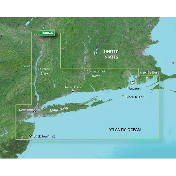
Garmin
Garmin VUS004R G2 Vision New York
$349.99$298.99BlueChart® g3 Vision® HD - VUS004R - New York - microSD™/SD™Coverage:Providence to New York, includes Narragansett Bay, all of Long Island, the entire Hudson River, New York Harbor through Perth Amboy and Brick TownshipPremier...$349.99$298.99 -

Garmin
Garmin VUS008R G2 Vision Charleston To Jacksonville
$349.99$292.99BlueChart® g3 Vision® HD - VUS008R - Charleston to Jacksonville - microSD™/SD™Coverage:Cape Romain through St. Augustine including Charleston, Savannah and Jacksonville with the St. John's River covered to the Clay County line...$349.99$292.99 -
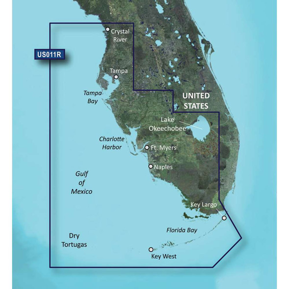
Garmin
Garmin VUS011R G2 Vision Southwest Florida
$349.99BlueChart® g3 Vision® HD - VUS011R - Southwest Florida - microSD™/SD™Coverage:Crystal River through Key Largo, including Tampa Bay, Ft. Myers, Lake Okeechobee, Florida Bay, Key West, and the Dry Tortugas.Premier Coastal Navigation...$349.99 -
Out of Stock
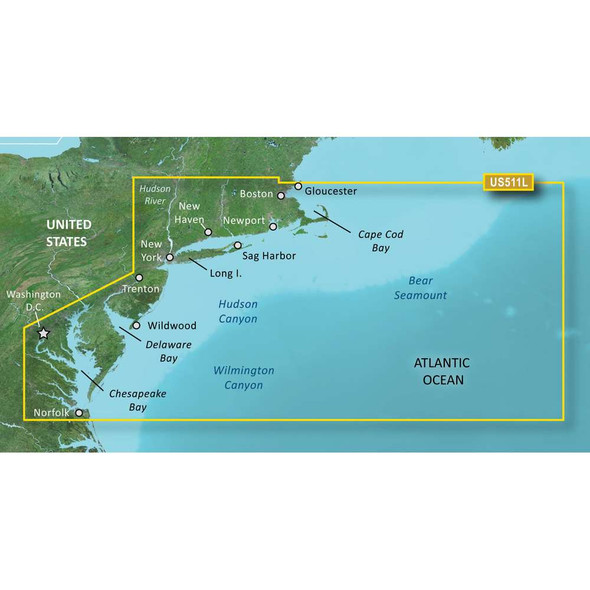
Garmin
Garmin VUS511L G2 Vision Boston - Norfolk
$449.99$373.99BlueChart® g3 Vision® HD - VUS511L - Boston - Norfolk - microSD™/SD™Coverage:Detailed coverage from Gloucester, MA to Wildwood, NJ., including Cape Cod, Martha's Vineyard, and Nantucket Island, as well as Long Island Sound, New York...$449.99$373.99 -
![Humminbird Humminbird LakeMaster VX - Mid-Atlantic States [601004-1] MyGreenOutdoors Humminbird Humminbird LakeMaster VX - Mid-Atlantic States [601004-1] MyGreenOutdoors](https://cdn11.bigcommerce.com/s-ktouu2lc/images/stencil/590x590/products/65767/128929/Humminbird-LakeMaster-VX-Mid-Atlantic-States-601004-1_85333__34849.1716045295.jpg?c=2)
Humminbird
Humminbird LakeMaster VX - Mid-Atlantic States [601004-1]
$149.99LakeMaster® VX - Mid-Atlantic StatesAn upgraded mapping solution in Humminbird LakeMaster VX to help anglers understand what is under the water’s surface better than ever before.For decades, Humminbird LakeMaster® has led the charge with...$149.99 -
![Humminbird Humminbird LakeMaster VX - Minnesota [601006-1] MyGreenOutdoors Humminbird Humminbird LakeMaster VX - Minnesota [601006-1] MyGreenOutdoors](https://cdn11.bigcommerce.com/s-ktouu2lc/images/stencil/590x590/products/65769/128931/Humminbird-LakeMaster-VX-Minnesota-601006-1_85335__54813.1716045303.jpg?c=2)
Humminbird
Humminbird LakeMaster VX - Minnesota [601006-1]
$149.99LakeMaster® VX - MinnesotaAn upgraded mapping solution in Humminbird LakeMaster VX to help anglers understand what is under the water’s surface better than ever before.For decades, Humminbird LakeMaster® has led the charge with the most...$149.99 -
![Humminbird Humminbird LakeMaster VX - Ontario [601020-1] MyGreenOutdoors Humminbird Humminbird LakeMaster VX - Ontario [601020-1] MyGreenOutdoors](https://cdn11.bigcommerce.com/s-ktouu2lc/images/stencil/590x590/products/65771/128933/Humminbird-LakeMaster-VX-Ontario-601020-1_85337__41600.1716045311.jpg?c=2)
Humminbird
Humminbird LakeMaster VX - Ontario [601020-1]
$149.99LakeMaster® VX - OntarioAn upgraded mapping solution in Humminbird LakeMaster VX to help anglers understand what is under the water’s surface better than ever before.For decades, Humminbird LakeMaster® has led the charge with the most...$149.99 -
![Humminbird Humminbird LakeMaster VX - Western States [601009-1] MyGreenOutdoors Humminbird Humminbird LakeMaster VX - Western States [601009-1] MyGreenOutdoors](https://cdn11.bigcommerce.com/s-ktouu2lc/images/stencil/590x590/products/65774/128936/Humminbird-LakeMaster-VX-Western-States-601009-1_85340__17399.1716045323.jpg?c=2)
Humminbird
Humminbird LakeMaster VX - Western States [601009-1]
$149.99LakeMaster® VX - Western StatesAn upgraded mapping solution in Humminbird LakeMaster VX to help anglers understand what is under the water’s surface better than ever before.For decades, Humminbird LakeMaster® has led the charge with the...$149.99 -
![Humminbird Humminbird LakeMaster VX Premium - Ontario [602020-1] MyGreenOutdoors Humminbird Humminbird LakeMaster VX Premium - Ontario [602020-1] MyGreenOutdoors](https://cdn11.bigcommerce.com/s-ktouu2lc/images/stencil/590x590/products/65786/128948/Humminbird-LakeMaster-VX-Premium-Ontario-602020-1_85352__17561.1716045370.jpg?c=2)
Humminbird
Humminbird LakeMaster VX Premium - Ontario [602020-1]
$249.99LakeMaster® VX Premium - OntarioAn upgraded premium mapping solution in Humminbird LakeMaster VX to help anglers understand what is under the water’s surface better than ever before.For decades, Humminbird LakeMaster® has led the charge...$249.99 -
![Raymarine Raymarine LightHouse Chart North America [R70794] MyGreenOutdoors Raymarine Raymarine LightHouse Chart North America [R70794] MyGreenOutdoors](https://cdn11.bigcommerce.com/s-ktouu2lc/images/stencil/590x590/products/59433/122645/Raymarine-LightHouse-Chart-North-America-R70794_76239__86467.1716021487.jpg?c=2)
Raymarine
Raymarine LightHouse Chart North America [R70794]
$169.99$157.99LightHouse Chart North AmericaLightHouse Charts North America chart coverage includes coastlines of the contiguous United States, Alaska, Hawaii, thousands of inland freshwater bodies of water, and the Bahamas. The chart also includes The Great Lakes,...$169.99$157.99 -
![Garmin [010-C1291-20] MyGreenOutdoors Garmin [010-C1291-20] MyGreenOutdoors](https://cdn11.bigcommerce.com/s-ktouu2lc/images/stencil/590x590/products/61996/125246/010-C1291-20_80132__70467.1716031277.jpg?c=2)
Garmin
[010-C1291-20]
$149.99$131.99Garmin Navionics+™ NSUS007R U.S. EastGet the world’s No. 1 choice in the marine mapping (based on 2020 reported sales) — with the best, most up-to-date Navionics®+ cartography on your compatible chartplotter. For offshore or inland...$149.99$131.99 -
Out of Stock
![C-MAP C-MAP 4D NA-D939 Passamaquoddy Bay to Block Island [NA-D939] NA-D939 MyGreenOutdoors C-MAP C-MAP 4D NA-D939 Passamaquoddy Bay to Block Island [NA-D939] NA-D939 MyGreenOutdoors](https://cdn11.bigcommerce.com/s-ktouu2lc/images/stencil/590x590/products/26297/107455/C-MAP-4D-NA-D939-Passamaquoddy-Bay-to-Block-Island-NA-D939_28269__73546.1715961293.jpg?c=2)
C-MAP
C-MAP 4D NA-D939 Passamaquoddy Bay to Block Island [NA-D939]
$207.00C-MAP 4D NA-D939 Passamaquoddy Bay to Block IslandThe next evolution in navigation solutions. C-MAP 4D adapts to your boating needs because it's the only digital chart that offers advanced features and lets you add data and services as they become...$207.00 -
Out of Stock
![C-MAP C-MAP 4D NA-D942 Norfolk to Jacksonville [NA-D942] NA-D942 MyGreenOutdoors C-MAP C-MAP 4D NA-D942 Norfolk to Jacksonville [NA-D942] NA-D942 MyGreenOutdoors](https://cdn11.bigcommerce.com/s-ktouu2lc/images/stencil/590x590/products/26300/107458/C-MAP-4D-NA-D942-Norfolk-to-Jacksonville-NA-D942_28272__66142.1715961306.jpg?c=2)
C-MAP
C-MAP 4D NA-D942 Norfolk to Jacksonville [NA-D942]
$207.00C-MAP 4D NA-D942 Norfolk to JacksonvilleThe next evolution in navigation solutions. C-MAP 4D adapts to your boating needs because it's the only digital chart that offers advanced features and lets you add data and services as they become available.Full...$207.00 -
Out of Stock
![C-MAP C-MAP 4D NA-D953 Point Sur to Cape Blanco [NA-D953] NA-D953 MyGreenOutdoors C-MAP C-MAP 4D NA-D953 Point Sur to Cape Blanco [NA-D953] NA-D953 MyGreenOutdoors](https://cdn11.bigcommerce.com/s-ktouu2lc/images/stencil/590x590/products/23131/106241/C-MAP-4D-NA-D953-Point-Sur-to-Cape-Blanco-NA-D953_25175__37799.1715956402.jpg?c=2)
C-MAP
C-MAP 4D NA-D953 Point Sur to Cape Blanco [NA-D953]
$207.00C-MAP 4D NA-D953 Point Sur to Cape BlancoThe next evolution in navigation solutions. C-MAP 4D adapts to your boating needs because it's the only digital chart that offers advanced features and lets you add data and services as they become available...$207.00 -
Out of Stock
![C-MAP C-MAP 4D NA-D954 Cape Blanco to Cape Flattery [NA-D954] NA-D954 MyGreenOutdoors C-MAP C-MAP 4D NA-D954 Cape Blanco to Cape Flattery [NA-D954] NA-D954 MyGreenOutdoors](https://cdn11.bigcommerce.com/s-ktouu2lc/images/stencil/590x590/products/23132/106242/C-MAP-4D-NA-D954-Cape-Blanco-to-Cape-Flattery-NA-D954_25176__65462.1715956405.jpg?c=2)
C-MAP
C-MAP 4D NA-D954 Cape Blanco to Cape Flattery [NA-D954]
$207.00C-MAP 4D NA-D954 Cape Blanco to Cape FlatteryThe next evolution in navigation solutions. C-MAP 4D adapts to your boating needs because it's the only digital chart that offers advanced features and lets you add data and services as they become available...$207.00 -
Out of Stock
![C-MAP C-MAP 4D NA-D959 Dixon Entrance to Cape St. Elias [NA-D959] NA-D959 MyGreenOutdoors C-MAP C-MAP 4D NA-D959 Dixon Entrance to Cape St. Elias [NA-D959] NA-D959 MyGreenOutdoors](https://cdn11.bigcommerce.com/s-ktouu2lc/images/stencil/590x590/products/23137/106247/C-MAP-4D-NA-D959-Dixon-Entrance-to-Cape-St-Elias-NA-D959_25181__03516.1715956425.jpg?c=2)
C-MAP
C-MAP 4D NA-D959 Dixon Entrance to Cape St. Elias [NA-D959]
$207.00C-MAP 4D NA-D959 Dixon Entrance to Cape St. EliasThe next evolution in navigation solutions. C-MAP 4D adapts to your boating needs because it's the only digital chart that offers advanced features and lets you add data and services as they become...$207.00 -
Out of Stock
![C-MAP C-MAP 4D Lakes NA-D072 North Central [NA-D072] MyGreenOutdoors C-MAP C-MAP 4D Lakes NA-D072 North Central [NA-D072] MyGreenOutdoors](https://cdn11.bigcommerce.com/s-ktouu2lc/images/stencil/590x590/products/40663/111008/C-MAP-4D-Lakes-NA-D072-North-Central-NA-D072_43918__24802.1715976068.jpg?c=2)
C-MAP
C-MAP 4D Lakes NA-D072 North Central [NA-D072]
$187.004D Lakes NA-D072 North CentralC-MAP charts have long been held in high regard by boaters because they combine aesthetically pleasing vector electronic charts with reliable sources. When buying C-MAP boaters can be assured that the charts they are...$187.00 -
Out of Stock
![C-MAP C-MAP 4D Lakes NA-D074 South East [NA-D074] MyGreenOutdoors C-MAP C-MAP 4D Lakes NA-D074 South East [NA-D074] MyGreenOutdoors](https://cdn11.bigcommerce.com/s-ktouu2lc/images/stencil/590x590/products/40665/111010/C-MAP-4D-Lakes-NA-D074-South-East-NA-D074_43920__97561.1715976076.jpg?c=2)
C-MAP
C-MAP 4D Lakes NA-D074 South East [NA-D074]
$187.004D Lakes NA-D074 South EastC-MAP charts have long been held in high regard by boaters because they combine aesthetically pleasing vector electronic charts with reliable sources. When buying C-MAP boaters can be assured that the charts they are...$187.00 -
Out of Stock
![C-MAP C-MAP 4D NA-D028 - Alaska - Full Content [NA-D028-FULL] NA-D028-FULL MyGreenOutdoors C-MAP C-MAP 4D NA-D028 - Alaska - Full Content [NA-D028-FULL] NA-D028-FULL MyGreenOutdoors](https://cdn11.bigcommerce.com/s-ktouu2lc/images/stencil/590x590/products/23097/106240/C-MAP-4D-NA-D028-Alaska-Full-Content-NA-D028-FULL_25141__72200.1715956398.jpg?c=2)
C-MAP
C-MAP 4D NA-D028 - Alaska - Full Content [NA-D028-FULL]
$353.00NA-D028 - AlaskaCoverage of the southern Alaska coast from Dixon Entrance up and over to Kodiak Island. Includes all of the Aleutian Islands out to Attu Island, Bristol Bay, and the North Slope over to Liverpool Bay in the Yukon Territory, Canada...$353.00 -
![C-MAP C-MAP M-NA-Y203-MS Chesapeake Bay to Bahamas REVEAL Coastal Chart [M-NA-Y203-MS] MyGreenOutdoors C-MAP C-MAP M-NA-Y203-MS Chesapeake Bay to Bahamas REVEAL Coastal Chart [M-NA-Y203-MS] MyGreenOutdoors](https://cdn11.bigcommerce.com/s-ktouu2lc/images/stencil/590x590/products/59035/122245/C-MAP-M-NA-Y203-MS-Chesapeake-Bay-to-Bahamas-REVEAL-Coastal-Chart-M-NA-Y203-MS_75517__19909.1716019946.jpg?c=2)
C-MAP
C-MAP M-NA-Y203-MS Chesapeake Bay to Bahamas REVEAL Coastal Chart [M-NA-Y203-MS]
$260.00M-NA-Y203-MS Chesapeake Bay to Bahamas REVEAL™ Coastal ChartWhether cruising or fishing, C-MAP REVEAL™ Coastal charts offer the very best of C-MAP. With Shaded Relief, including Reveal Seafloor, Aerial Photography, Satellite Overlay and...$260.00 -
![C-MAP C-MAP M-NA-Y204-MS Gulf of Mexico to Bahamas REVEAL Coastal Chart [M-NA-Y204-MS] MyGreenOutdoors C-MAP C-MAP M-NA-Y204-MS Gulf of Mexico to Bahamas REVEAL Coastal Chart [M-NA-Y204-MS] MyGreenOutdoors](https://cdn11.bigcommerce.com/s-ktouu2lc/images/stencil/590x590/products/59036/122246/C-MAP-M-NA-Y204-MS-Gulf-of-Mexico-to-Bahamas-REVEAL-Coastal-Chart-M-NA-Y204-MS_75518__67097.1716019950.jpg?c=2)
C-MAP
C-MAP M-NA-Y204-MS Gulf of Mexico to Bahamas REVEAL Coastal Chart [M-NA-Y204-MS]
$260.00M-NA-Y204-MS Gulf of Mexico to Bahamas REVEAL™ Coastal ChartWhether cruising or fishing, C-MAP REVEAL™ Coastal charts offer the very best of C-MAP. With Shaded Relief, including Reveal Seafloor, Aerial Photography, Satellite Overlay and...$260.00 -
![C-MAP C-MAP M-NA-Y206-MS West Coast Baja California REVEAL Coastal Chart - Does NOT contain Hawaii [M-NA-Y206-MS] MyGreenOutdoors C-MAP C-MAP M-NA-Y206-MS West Coast Baja California REVEAL Coastal Chart - Does NOT contain Hawaii [M-NA-Y206-MS] MyGreenOutdoors](https://cdn11.bigcommerce.com/s-ktouu2lc/images/stencil/590x590/products/59038/122248/C-MAP-M-NA-Y206-MS-West-Coast-Baja-California-REVEAL-Coastal-Chart-Does-NOT-contain-Hawaii-M-NA-Y206-MS_75520__68291.1716019958.jpg?c=2)
C-MAP
C-MAP M-NA-Y206-MS West Coast Baja California REVEAL Coastal Chart - Does NOT contain Hawaii [M-NA-Y206-MS]
$260.00M-NA-Y206-MS West Coast & Baja California REVEAL™ Coastal Chart - Does NOT contain HawaiiWhether cruising or fishing, C-MAP REVEAL™ Coastal charts offer the very best of C-MAP. With Shaded Relief, including Reveal Seafloor, Aerial...$260.00 -
![C-MAP C-MAP M-NA-Y215-MS US Lakes South Central REVEAL Inland Chart [M-NA-Y215-MS] MyGreenOutdoors C-MAP C-MAP M-NA-Y215-MS US Lakes South Central REVEAL Inland Chart [M-NA-Y215-MS] MyGreenOutdoors](https://cdn11.bigcommerce.com/s-ktouu2lc/images/stencil/590x590/products/59046/122256/C-MAP-M-NA-Y215-MS-US-Lakes-South-Central-REVEAL-Inland-Chart-M-NA-Y215-MS_75528__25914.1716019989.jpg?c=2)
C-MAP
C-MAP M-NA-Y215-MS US Lakes South Central REVEAL Inland Chart [M-NA-Y215-MS]
$179.00M-NA-Y215-MS US Lakes South Central REVEAL™ Inland ChartWhether cruising or fishing or C-MAP® REVEAL™ Lakes charts offer the very best of C-MAP. With Shaded Relief, including Reveal Seafloor, Aerial Photography and Satellite Overlay...$179.00 -
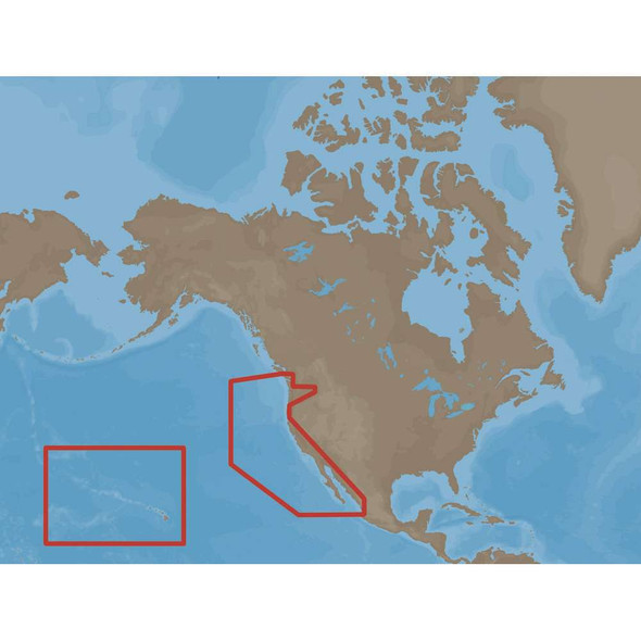
C-MAP
C-MAP MAX NA-M024 - U.S. West Coast & Hawaii - SD™ Card
$291.00NA-M024 => USA West Coast and HawaiiCoverage of the Pacific Coast of the United States, including all of the coasts of California, Oregon and Washington. Coverage of Baja California and Mexico down to Puerto Vallarta. Detail of the Columbia River,...$291.00 -
Out of Stock

C-MAP
C-MAP NA-M022 Max Wide C Card East Coast And Bahamas - 30129
$279.00NA-M022 => USA East Coast and BahamasCoverage of the United States Atlantic coast from Passamaquoddy Bay, ME down to Key West, FL, with extended coverage into the Gulf of Mexico over to Perdido Bay, FL. Includes coverage of Bermuda and all of the...$279.00 -
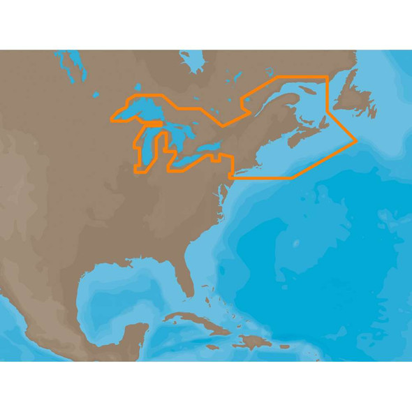
C-MAP
C-MAP NA-M026 Max Wide SD Card Great Lakes And Maritimes - 30143
$291.00NA-M026 => Great Lakes, Northeast Coast and ApproachesCoverage of the Great Lakes, St. Lawrence River and Northeast United States. Coverage of the Great Lakes also includes Fox River and Lake Winnebago, Lake St. Clair, Rideau Canal, Ottawa River and...$291.00 -
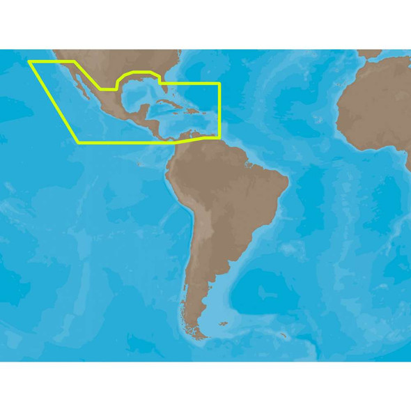
C-MAP
C-MAP NA-M027 Max Wide SD Card Central America & Caribbean - 30146
$291.00NA-M027 => Central America and CaribbeanCoverage of Central America, all of the Caribbean and the northern coast of South America, and the Gulf of Mexico. Coverage of the Pacific coast starts at Point Conception, CA and runs down to Bahia Cupica,...$291.00 -
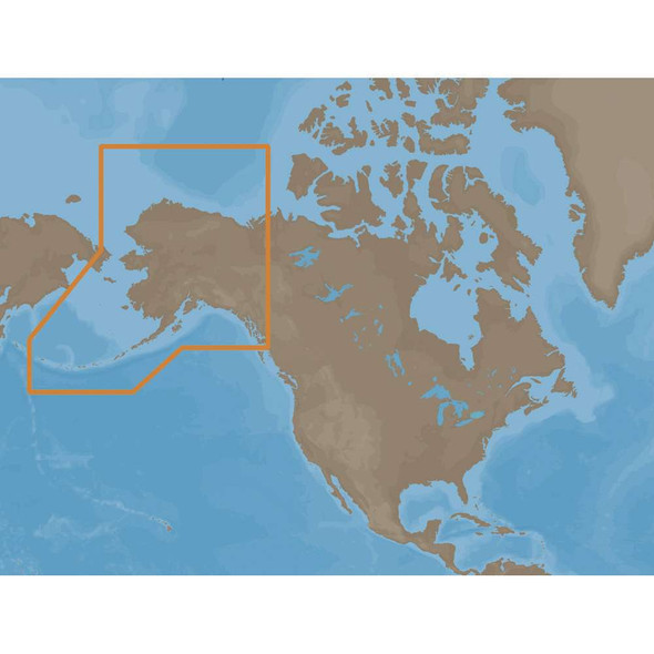
C-MAP
C-MAP NA-M028 Max Wide SD Card Alaska - 30149
$291.00NA-M028 => AlaskaCoverage of the southern Alaska coast from Dixon Entrance up and over to Kodiak Island. Includes all of the Aleutian Islands out to Attu Island, Bristol Bay, and the North Slope over to Liverpool Bay in the Yukon Territory, Canada. ...$291.00 -
![C-MAP C-MAP REVEAL X - Gulf of Mexico Bahamas [M-NA-T-204-R-MS] MyGreenOutdoors C-MAP C-MAP REVEAL X - Gulf of Mexico Bahamas [M-NA-T-204-R-MS] MyGreenOutdoors](https://cdn11.bigcommerce.com/s-ktouu2lc/images/stencil/590x590/products/62758/126186/C-MAP-REVEAL-X-Gulf-of-Mexico-Bahamas-M-NA-T-204-R-MS_81386__92274.1716034839.jpg?c=2)
C-MAP
C-MAP REVEAL X - Gulf of Mexico Bahamas [M-NA-T-204-R-MS]
$260.00REVEAL™ X - Gulf of Mexico & BahamasCOMPATIBILITY WITH SIMRAD NSX SERIES ONLYExperience the X Generation of C-MAP charts - with game-changing Shaded Relief!C-MAP® REVEAL™ X offers a fresh, dynamic experience. All the great features...$260.00 -
![C-MAP C-MAP REVEAL X - Nova Scotia to the Chesapeake Bay [M-NA-T-202-R-MS] MyGreenOutdoors C-MAP C-MAP REVEAL X - Nova Scotia to the Chesapeake Bay [M-NA-T-202-R-MS] MyGreenOutdoors](https://cdn11.bigcommerce.com/s-ktouu2lc/images/stencil/590x590/products/62756/126184/C-MAP-REVEAL-X-Nova-Scotia-to-the-Chesapeake-Bay-M-NA-T-202-R-MS_81384__70147.1716034831.jpg?c=2)
C-MAP
C-MAP REVEAL X - Nova Scotia to the Chesapeake Bay [M-NA-T-202-R-MS]
$260.00REVEAL™ X - Nova Scotia to the Chesapeake BayCOMPATIBILITY WITH SIMRAD NSX SERIES ONLYExperience the X Generation of C-MAP charts - with game-changing Shaded Relief!C-MAP® REVEAL™ X offers a fresh, dynamic experience. All the great...$260.00
